Fort Widley Nature Trail
Fort Widley Nature Trail
![]()
![]()
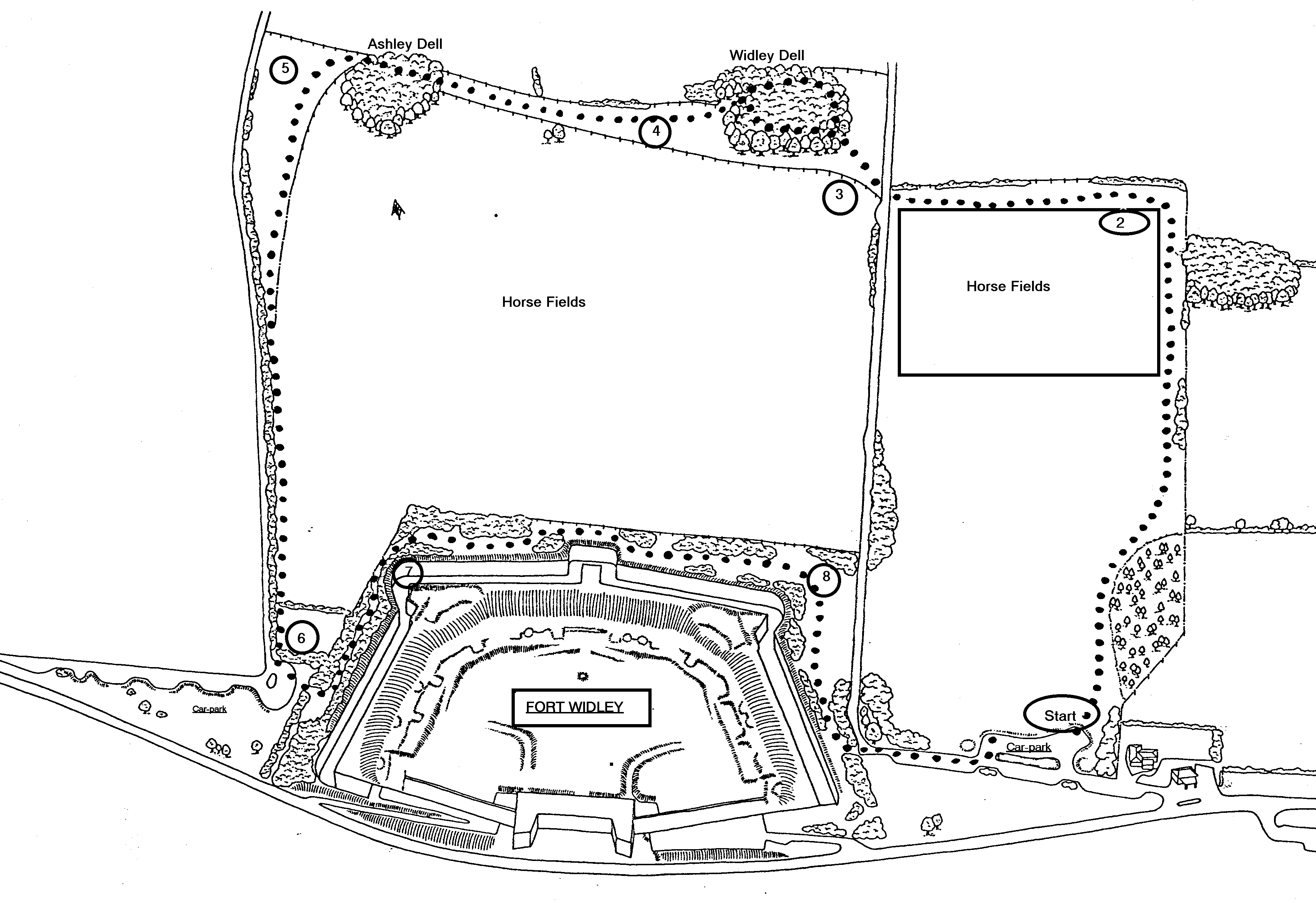 On
the map there are a number of car-parks shown by the initials 'CP'. You
can walk the trail from any of these but the description below starts from the
number 1 close to 'The Churchillian' pub.
On
the map there are a number of car-parks shown by the initials 'CP'. You
can walk the trail from any of these but the description below starts from the
number 1 close to 'The Churchillian' pub.
From the car-parks at the top of the slope walk down the right hand side of the field. You pass some young trees on the right which are known as the children's wood. These were planted by local school children in the early 1990s. At the bottom of the wood walk between the hedge on your left and the fence on your right. Notice how the hedge has been 'laid'. Hedge laying is a technique of managing a hedge to thicken it to produce a good stock proof hedge. This hedge was originally planted as part of the Portsdown Restoration and Conservation project. A variety of native species shrubs have been planted - how many can you find and identify?
Turn left at the bottom following the hedge to the lane at Widley Walk.
At (2) on the map carefully cross the lane and go into the 'Two Dells' section of the trail. The first Dell or copse (3) you walk through has a lot of hazel in it among the taller trees and more has recently been planted. There are more wild flowers on this section of the path than you will have come across so far. as you leave the copse the area of long grass some times shelters pheasants and we once found a harvest mouse nest here. The next copse (4) has signs of badgers. Sett entrances on the path now look disused but there are more in the trees to the left of the path.
Turn up the slope after you leave the copse and the field (5) is once again a good spot to look for wild flowers and butterflies. There used to be a lot of centaury but the grass may have suppressed this more recently. In late 2010/11 a lot of work has gone on to improve the hedge and clear old fencing to make this section of the walk more wildlife friendly and more interesting. Sections of the laid hedge are now showing new growth. About half way up the slope there is a gap in the hedge giving access across the lane to a walkway west across the fields and up to the road by the radar site, where you can cross the road into the flower rich 'Top field'. The verge of the lane alongside the hedge is also being cleared which will allow wild flowers to thrive. At the top of the slope you can see the pony fields on your left where the ponies have usually eaten the grass down to ground level which means there are virtually no flowers in the fields.
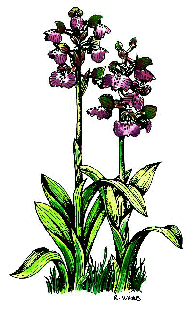
At the top turn left and left again to get on the path round the back of the fort. (6). Scrub has been cleared from this area to open it up and there is a good range of flowers to see including orchids, nettle-leaved bellflower and a lot more. There have been small blue butterflies on the path here and you can also enjoy the views to the north.
The Fort has been used in recent years (2010) for Fire and Rescue services to train for dealing with natural disasters and in the mote you can see some of the 'disaster' set ups they use.
When you get to the end of the fort you can walk straight on across Widley Walk and over the grass back to the car-park or continue round the fort enjoying more wild flowers like nettle-leaved bell flower and the aromatic tansy (From July onwards) and butterflies and turn left back to the car park
--
people have
viewed this page since 1st December 2010